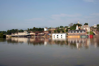
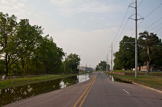
A bit of traveling has kept me away from the ol' blog, but here are some photos taken on Saturday, May 21, two days after the historic 57.1-foot crest of May 19. Water level at the time these photos were taken was 56.6. The photo above and below are of the Glass Road area.
North of Vicksburg
I have posted these aerial photos before, but doing it again to complete this day's shoot.
These photos were from a ride aboard the Sweet Olive that my wife, Karen, and I took on Saturday afternoon, May 21. What a wonderful adventure! If you haven't ridden aboard the Sweet Olive, what are you waiting for?
The Sweet Olive was not allowed to go downriver underneath the bridges, but we went upriver for quite a ways.
This is the railroad track on North Washington Street across from the National Cemetery.
This bird is standing on one of the railroad tracks. I love this photo.
Showing posts with label vicksburg flood pictures. Show all posts
Showing posts with label vicksburg flood pictures. Show all posts
Thursday, June 9, 2011
Monday, May 23, 2011
Vicksburg Flood 2011: Yazoo River Bridge/Redwood
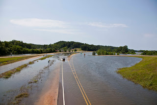
I rode up to the Redwood community Saturday morning to see how the Redwood Elementary School was faring and to also see how far over US 61 the floodwaters came. See for yourself! As always, click on the photos to enlarge them.
Notice the sleeping dog. I let him lie.
Dump trucks were running constantly while I was there. Some went up the exit ramp and then around, but some cut right through the water on the road. This is looking north.
Looking north. The Yazoo River bridge rises in the background.
On top of the exit ramp looking south.
On top of the exit ramp looking north.
The Yazoo River from atop the bridge, looking west.
The Yazoo River from atop the bridge, looking east. The guys in the boat looked like they were taking water measurements.
Northeast
West
Northwest
Northwest
North
North
Southeast
Southwest
South
The Great River Road.
Notice the sleeping dog. He found some shade.
Subscribe to:
Posts (Atom)


